Iceland’s northern region is just a few kilometers away from the Arctic Circle. The landscapes are filled with snowy mountain peaks and green meadows, but the area doesn’t lack wild canyons or waterfalls either. The steaming geothermal fields and whale-filled bays only add to the touristic value of this remarkable region.
In this article, you’ll learn about North Iceland’s must-visit places and natural attractions. We’ve written a separate article including practical travel information for North Iceland, so make sure to check it out as well!
Regions in North Iceland
North Iceland is such a huge region that it’s been divided into three areas: Northeast and Northwest Iceland and the Northern Highlands. Of the two halves, Northwest Iceland is more popular. This area is halfway between Reykjavík and Akureyri, which are the two largest cities in the country.
Northeast Iceland is just as stunning as its western counterpart, but sadly, it’s much less popular. Both of these northern areas are great places to visit. If you’re coming to North Iceland, plan ahead, look for detours from the main road, and take these fjord side roads into the remote areas. You definitely won’t be disappointed.
Northeast Iceland
Northeast Iceland has four peninsulas: Flateyjarskagi, Tjörnes, Melrakkaslétta, and Langanes. They’re renowned for their remoteness, beautiful turf houses, and oceanside cliffs packed with puffins and other seabirds. The whole of the Northeast Iceland area is a truly off-the-beaten-path destination full of hidden and overlooked natural wonders.
Flateyjarskagi Peninsula
This mountainous region in North Iceland can be found between Akureyri and Húsavík. The peninsula itself is practically deserted, which makes it remote enough to be a prime hiking area. Flateyjarskagi is easy to access and home to the second-largest – and oldest – forest in Iceland: Vaglaskógur. The western part, in particular, is known for being home to the Laufás Turf House Museum.

Tjornes Peninsula
If you want to experience the wild, untouched beauty of Northeast Iceland, Tjörnes is a wonderful way to begin. This peninsula offers isolated sea cliffs that provide wonderful views over the Arctic Ocean. Húsavik, also known as the whale watching capital of the country, is the most famous village here. In this village, you can find daily whale watching boats as well as an educational whale museum.

Melrakkaslétta Peninsula
Melrakkaslétta is sadly an overlooked region in Iceland. This peninsula has a lot of personality with its lonely mores, driftwood-filled beaches, and howling winds. It’s also home to an earthquake center as well as interesting coastal formations where millions of birds nest, such as the great skua, the razorbill, and the rare and elegant gyrfalcon.
The main attraction of the peninsula is its epic Arctic Henge monument, which was built in 1996. The inspiration for this monument, made of four triangular peaks, was taken from an Eddic poem. The peaks themselves are made up of 72 smaller pieces, each of which has been inscribed with a dwarf’s name. The mystical structure is a fantastic location both for Northern Lights and midnight sun watching.

Langanes Peninsula
For those bird lovers out there, Langanes Peninsula is the place to go for excellent birdwatching spots and a seemingly endless collection of bird cliffs. For those history lovers, Heiðarfjall has some fascinating ruins to explore, including a Cold War-era NATO radar station, which operated from 1954–1968. There are many abandoned settlements nearby at Langanes, adding a spooky mood to the atmosphere.

Grimsey Island
Grímsey is special for a number of reasons. First, it’s the northernmost landmass in Iceland to have people living on it. That’s important when you consider that the Arctic Circle actually cuts across this verdant, grassy island. Many visitors travel to Grimsey just to step into the Arctic Circle, which is the best place to watch the true midnight sun from. This natural phenomenon is visible in Grimsey for an entire month in the summer.

Lake Myvatn
Among all the isolated gems and wonderful sights, one of the most popular locations in Northeast Iceland is Lake Mývatn and the area that surrounds it. This isn’t only true in the north but in all of Iceland.
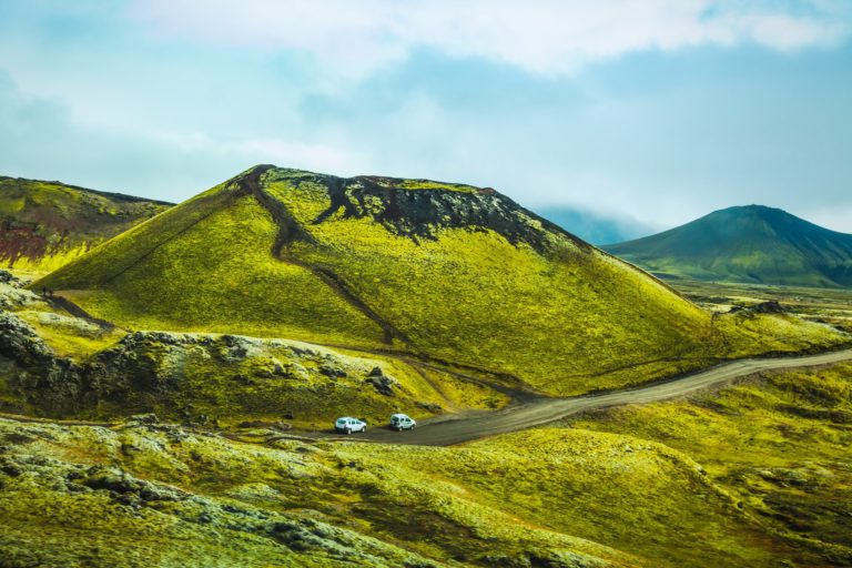
Mývatn is surrounded by rugged lava fields, impressive craters, and hissing hot springs. This makes sense when you consider that the lake itself is the product of a volcanic eruption that happened around 2300 years ago. Among the many popular sightseeing options, we’d recommend visiting the Hverir geothermal area, the pseudocraters at Skútustaðir, the Mývatn Nature Baths, and the lava rock garden at Dimmuborgir.

Dimmuborgir
Dimmuborgir, whose name means the “Black Fortress,” is a dramatic lava garden in the Lake Mývatn area. It was formed in an eruption about 2300 years ago. As lava flooded the area, it passed over the lake, causing the water to boil. The reaction between the cold water, the bubbles from the boiling water under the lava, and the intense steam created unusual lava formations, pillars, caves, and caverns.
Dimmuborgir looks like a scary troll castle with labyrinths, hidden chambers, and rising towers. It’s no wonder why Icelandic folk tales refer to the place as the home of the trolls.
Hverir, Námafjall Geothermal Area
The most famous geothermal area in North Iceland is the Námafjall Geothermal Area, also known as Hverir. Here, smoking fumaroles, steam vents, picturesque cracked mud, and colorful boiling hot springs can be seen accompanied by the overwhelming smell of sulfur. This orangy-red, out-of-this-world landscape has made Hverir a very popular tourist destination.

Skútustaðir Pseudocraters
The Skútustaðagígar pseudocraters are best viewed from a helicopter or a drone. The craters have actually never produced any magma. They were formed by the same interaction between the lava and water as Dimmuborgir. Gas explosions created the craters when boiling lava flowed over the water about 2300 years ago. You’ll find marked paths to walk through the area. There is a short, circular route on the west side of the site that only takes 20–30 minutes total.
The Diamond Circle
If you want to see the highlights of this region, the Diamond Circle tour route connects a number of them. Included in the Diamond Circle are Lake Mývatn, the crescent-shaped Ásbyrgi Canyon, and two picturesque waterfalls: the historic Goðafoss and Dettifoss, the most powerful waterfall in Europe. It also takes you to Húsavík, which is the whale watching capital of Iceland, where you can experience the beauty of these majestic sea mammals in the deep blue water.
Goðafoss Waterfall
Goðafoss is 12-m (39-ft) high and 30-m (98-ft) wide waterfall with an impressive circular shape and a fascinating history. Þorgeir Ljósvetningagoði, a law speaker, made Christianity the official religion in 1000 AD. After officially converting the country, he threw all of the pagan idols and statues into the waterfall as a symbol of his decision. Since then, it has been known as Goðafoss.

Dettifoss Waterfall
Dettifoss is widely known as the most powerful waterfall in Europe. It’s located on the river called “Jökulsá á Fjöllum,” which originates from the enormous Vatnajökull glacier. The water drops 5 m (16.4 ft.) into a canyon and the cascade is about 100 m (328 ft.) wide. It has an impressive water flow of 400 m3/s on average in summer!

Ásbyrgi Canyon
Asbyrgi, meaning the “Shelter of the Gods,” is an impressive horseshoe-shaped canyon. It has 100-m (238-ft) cliffs and offers visitors some of the best views in Iceland from its forests full of birches and willows. The canyon is approximately 3.5 km (2.2 mi.) in length and 1.1 km (0.7 mi.) in width. According to legends, the canyon was formed by Sleipnir, Odin’s eight-legged flying horse, who left his hoof print in the landscape.
Geologists, however, have proven that Asbyrgi was created by a catastrophic glacial river flood thousands of years ago. Rumors say that this mystical place is the capital of the “Huldufolk,” the magical hidden people.

Jokulsárgljufur (Vatnajokull National Park)
The glacial river Jökulsá travels through Jökulsárgljúfur, whose name actually translates as “Glacial River Canyon.” This region, at the northern end of Vatnajökull National Park, is geographically connected to the rest of the park thanks to this river.
The canyon itself is one of the deepest in the country. With a length of 25 km (15.5 mi.), a width of 500 m (1640 ft.), and a depth of 100–120 m (328–393 ft.) in many places, it’s sure to take your breath away. If the canyon weren’t enough, Jökulsárgljúfur is also popular for its collection of waterfalls: Dettifoss, Hafragilsfoss, Selfoss, and Réttarfoss. Jokulsárgljufur was a filming location for several Hollywood movies, including Prometheus and Oblivion.

Northwest Iceland
There are three large peninsulas in Northwest Iceland: Vatnsnes, Trollskagi, and Skagi. The land here is gentle, fertile, and beautiful, with landscapes dotted with lonely barns and farmhouses watched over by silent, snow-capped mountains.
Vatnsnes Peninsula
One of the largest seal colonies in the country calls Vatnsnes Peninsula its home. To learn more about these animals, you can visit the Icelandic Seal Centre in Hvammstangi. The other major attraction on the peninsula is Hvítserkur rock formation. This 15-m (49-ft) sea stack stands right on the shore and looks like a giant mammoth or troll drinking from the sea.
Hvítserkur
Hvítserkur is a 15-m (49-ft) tall basalt sea stack and a popular location for photographers. The rock formation is often referred to as the “Troll of the North,” while some people see a mammoth or an elephant in it. The unusual shape definitely resembles some kind of animal that appears to be drinking from the sea.
This rock formation is the ultimate nesting ground for many bird species, making it worthy of its name, which translates to “white shirt” in reference to the color of the bird droppings that cover the rock.

Skagi Peninsula
This region is most famous for horse breeding. In fact, there are more horses living in Skagafjörður than humans. Apart from the horses, this region is prosperous thanks to its agriculture, dairy, and sheep farming in particular.
Glaumbaer Turf Farm
At the base of the peninsula, between Skagi and Trollaskagi, is Glaumbaer, a beautiful, historic turf farm that’s believed to be about 900 years old. This historic farm is believed to be the birthplace of Snorri Þorfinnsson, who lived here in the 11th century. Although not many Americans know about it, Snorri was the first European to be born in America while his parents were on exploration there long before Columbus discovered America.
People lived in Glaumbær turf house until 1947. The present farmhouse consists of 13 buildings and the “newest” addition to the turf house was built in 1876-1879. The oldest parts of the turf house date back to the mid 18th century.

Trollaskagi Peninsula
Tröllaskagi has the most dramatic views in all of North Iceland. The peninsula is packed with enormous mountains, some of which even feature small glaciers on top. The tallest peak is Mount Kerling, which measures over 1500 m (4921 ft.) in height. The area is a beloved hiking destination in summer and a popular skiing destination for the adventurous in winter.
There is a fantastic geothermal swimming pool on the east coast of the peninsula, located on a cliff at Hofsós, that provides scenic views over the bay and the flat island of Drangey. One interesting attraction in the area is the Beer Spa at the Kaldi brewery in Árskógasandur. They invite visitors to bathe in tubs filled with warm beer while drinking cold craft beer from the tap. Eyjafjörður (between Trollaskagi and Flateyjarskagi Peninsula) is the country’s longest fjord and is filled with whales all year, but especially in the summer.

Siglufjordur Town
Siglufjörður is Iceland’s northernmost town and is a historic shark and herring fishing town. Its fame and fortune have always been linked to the ebb and flow of the fishing industry. It’s home to the Herring Era Museum, which has won an international award.
The place is also famous for its spectacular natural beauty. There are breathtaking mountains and fjords here as well as an almost unending list of outdoor activities and recreation opportunities. Of all of the ski areas in the country, the one in Skarðsdalur is definitely one of the best.

Dalvík Village
Dalvík is one of Iceland’s most famous whale-watching destinations. The whale watching tours here have a success rate of 95–99% on average. Sharing the same natural surroundings as Siglufjordur, Dalvik offers a fantastic ski area as well as beautiful nature in every direction. Just outside Dalvik is a nice golf course and the valley offers some great hiking trails with magnificent views.
Every year, the city holds a fish festival in August, on the first Saturday after the first Monday. The local fishing industry sponsors one of the offerings, which is a free fish buffet. This is part of the reason behind the popularity of the event, attended by up to 30,000 people each year. There are also many musical acts that perform on the main stage in the evening. This is a great event to keep in mind if you’ll be in North Iceland in early August. Don’t miss it!
Akureyri Town
With a population of about 19,000 people, Akureyri is Iceland’s fourth-largest city. In fact, it’s the largest city outside Iceland’s capital area and southwest corner.
Nicknamed the “Capital of North Iceland,” Akureyri is an important base for tourists traveling around the country. It offers plenty of hotels, restaurants, large supermarkets, museums, and “city life” that could be called vibrant, according to Icelandic standards.
Akureyri was first settled in the 9th century and was later urbanized, becoming a municipality in the 16th century. The town is situated at the base of beautiful Eyjafjörðurfjord and is surrounded by snowy mountains where many locals come to ski in the winter. Akureyri is a great base to explore North Iceland from at any time of year.


