Nowhere else in the world can you find so many outstanding natural attractions located so close to the capital as in South Iceland. The sights here are so close to each other and so easily accessible from the main road that the region is by far the most beloved tourist destination in all of the country.
The South Coast along the Ring Road is packed with spectacles, each of which deserves a position on the list of top natural wonders of the world. The overall landscape in between them is just fabulous. Further inland, in the Southern Highlands, even more extraordinary areas are waiting hidden off the beaten track, which will definitely exceed your expectations.
South Iceland is home to the country’s most famous tour routes, including the epic Golden Circle and Laugavegur Trail, a favorite among hikers. No wonder so many visitors don’t bother traveling beyond the southern region. They’re simply satisfied with the beauty that they find here! In this article, you’ll learn about South Iceland: its weather, infrastructure, and available activities so that you can plan your trip easily.
How to Get Around in South Iceland
South Iceland, known as “Sudurland” in Icelandic, is easily accessible from Reykjavik. The main road that circles the island takes you to the South Coast, where the most dramatic landscapes in Iceland can be found. As soon as you leave the capital area behind, the scenery starts to change and the further you travel, the more impressive it gets.
Since this region is located so close to Reykjavík, exploring the South Coast can be done in just one day – if you only visit the most popular attractions. The drive from Reykjavík to Vík, stopping at the major waterfalls and beaches, takes about 10–12 hours, depending on how much time you want to spend at each location.
Ideally, you’ll drive even further east to visit Vatnajokull Glacier, the Jokulsarlon Glacier Lagoon, and the Diamond Beach. This can be done in 14–15 hours, round trip, so it’s only doable in summer when the nights are completely bright.
To explore the Golden Circle in Southwest Iceland, you’ll leave the main road and follow some smaller roads to complete the circle before returning to Reykjavik. Driving the entire route takes about 5–6 hours if you only stop at the major locations, but you can spend more time here and visit more places, of course.
In general, the Highlands area is only accessible by rental car in the summer, but there are guided group tours all year round. The roads are unpaved and conditions can be challenging even in summer, so a good amount of driving experience is required if you’d like to travel without a guide.
The most varied tours and activities are offered in this region. Driving a rental car, a campervan, a motorhome, or joining a guided tour are all amazing ways to explore this area.

Public Transport
Exploring South Iceland on public transportation isn’t the best idea. Buses in the countryside only run once per day at most. The problem is that buses don’t usually make stops outside of the villages and won’t make any detours to the natural attractions. This makes it impossible to explore South Iceland’s must-visit locations using only public transport.
Guided Tours
Your best option, if you don’t want to use public transport, would usually be to join a guided group tour. These can sometimes be more affordable than the local buses. They also have the added bonus of offering stops at all of the must-see locations while your local guide shares tips and information in English.
If you’d like to explore the region on a guided sightseeing tour, you’re in luck. This is the most traveled area in all of Iceland and the tour options are varied and abundant. Sightseeing day tours are offered from Reykjavik to Vík or even to the Jokulsarlon Glacier Lagoon in Southeast Iceland.
The Vik tour takes about 10–12 hours, roundtrip, with plenty of stops along the way. The Jokulsarlon tour is longer, taking 14–15 hours. There are two- or three-day tours available in the area as well, which can be enriched with exciting activities such as glacier hiking and sailing across a glacier lagoon.
Golden Circle tours have plenty of options, including shorter and more extended versions. The shorter version is usually 5–6 hours long while the longer version will take a whole day. You can also connect the Golden Circle and South Coast tour into one multi-day trip.
Tours to the Highlands are called Superjeep tours, referring to the size of the vehicle you’ll take. These exciting trips often include driving on wild terrain or even crossing rivers with these specially-built high-clearance cars. The Highlands tours usually offer some hiking, geothermal bathing, or free time to spend at the main destination.

Self-Drive Tours
While you could easily drive around South Iceland yourself, finding the stops, gathering information, building your itinerary, and adhering to your plans are extra tasks that you’ll have to complete before and during the trip. So, here’s a little help planning your trip to Iceland.
If you decide to rent a car and travel around South Iceland without a local guide, you’ll need at least 4–6 days to visit all the areas we’ve listed below in this article. But of course, the longer you stay in the area, the more places you can explore.
You can also join some guided activity tours once you’re at these locations. There are, for example, guided glacier hiking tours that depart from Vik or Skaftafell, horseback riding on the Black Sand Beach, and hiking trips in Thorsmork and Landmannalaugar. Ask for recommendations at the tourist visitor centers, guesthouses, and other tourist service facilities.

Infrastructure
Although quite sparsely populated, South Iceland is the most traveled region in the country. Therefore, you’ll see plenty of other cars on the roads. You won’t have to worry about traffic jams though, these aren’t an issue in Iceland.
Even the smallest villages are well prepared for visitors and you’ll find a good number of gas stations, restaurants, and supermarkets. The largest towns on the South Coast are Sellfoss, Hvolsfollur, Vik, and Kirkjubaerklaustur. This is where you’ll find everything you need during your trip.
In the Southern Highlands area, however, the opposite is true. The interior of the island is uninhabited and there isn’t a single supermarket or gas station here. In summer, at the largest campsites in Landmannalaugar and Thorsmork, you’ll be able to buy some food and there are public toilets that you can use for a small fee. But it’s always best to stock up in the city before leaving civilization behind.
There are mountain huts in the Highlands, but you’ll need to reserve your place months in advance if you’d like to stay there. Otherwise, the most common type of accommodation in this area is camping in tents.
In the populated areas outside of the Highlands, despite the good infrastructure, the accommodation options are still limited compared to the demand. This is especially true in the high seasons, so it’s best to book everything in advance.

Road Conditions
The main road and all the paved roads in South Iceland are generally in good condition and are easy to drive. In the winter, although they are maintained, the roads can still be icy and snowy, but that’s quite normal in Iceland.
While the paved roads are maintained all year round, the Highland roads are inaccessible for normal cars most of the year. The conditions are challenging in this area in winter, which lasts from October to May in the Highlands. Visiting the Highlands in summer requires good driving skills and a large four-wheel drive car. In winter, you’ll need to join a guided Superjeep tour if you want to visit the Highlands.

The Weather in South Iceland
The weather in South Iceland is a little bit milder than in the rest of the country. A branch of the warm Gulf Stream, known as the Irminger Current, flows around the southern coasts, affecting the sea temperatures, which are the warmest here. This current also affects the temperatures and the weather patterns along the coast.
The average temperatures are somewhat warmer here than in East and North Iceland. This area receives the greatest amount of precipitation in the country throughout the year, especially near the glaciers, which comes mostly in the form of rain and snow.
The winds can also be especially strong near the glaciers. These are called the so-called Katabatic winds, caused when high-density air from higher elevations travels with a great force down a slope under the force of gravity.
As the Ring Road passes right next to the glaciers, it’s important to keep an eye out for the wind speed and wind gusts on the Icelandic Road and Coastal Administration’s website, especially if you’re driving in winter. Learn more about Iceland’s weather here and check out the current weather forecast here.

Geology
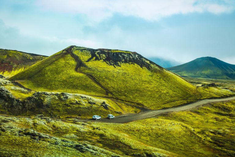
Iceland sits on top of the rift zone created by the separation of the Earth’s tectonic plates. A hotspot lies right underneath Iceland, here, on the Mid-Atlantic Ridge. This mantle plume, as it’s known, is centered underneath Vatnajökull Glacier. In South Iceland in particular, the natural interaction between the mantle plume and the rift zone has created an area full of a variety of volcanic activity.
This volcanic activity is what helps to make South Iceland so unique. Its effects on the landscape and natural qualities of the area can’t be underestimated. To recognize the international geological significance of this extraordinary scenery, a large part of South Iceland was given the title of UNESCO Global Geopark.
The area around Katla Geopark is considered to be the most volcanically active part of the country. Eyjafjallajökull, Katla, and Grímsvötn are particularly active volcanic systems. Containing 30–40 km³ (7.2–9.6 cu. mi.) of magma, the caldera measures 110 km2 (42.4 sq. mi.) and dives 700 m (2296 ft.) under the ground. Apart from the volcanoes, this area is marked by fissures, eruptive craters, lava fields, table mountains (tuya), rootless cones, and impressive hyaloclastite ridges.

Surtsey is the southernmost point of Iceland, located in the Vestmannaeyjar archipelago off the southern coast. The country’s newest island was formed in a volcanic eruption which lasted from 1963 to 1967. Today, Surtsey is a UNESCO World Heritage site and is one of the most researched places in the world. In this pristine natural laboratory, free from human interference, Surtsey has been producing unique long-term information on the colonization process of new land by plant and animal life.
Ice caps top the tallest volcanoes here. These prominent features can be seen throughout the landscapes along with outlet glaciers, glacial rivers, and other glacial landforms including ice-dammed lakes and moraines. In 2019, Vatnajökull National Park was added to the UNESCO World Heritage list.
The extensive outwash plains that can be found in the lowlands were created by large floods, which were themselves usually caused by the glacial outbursts (jökulhlaup) from subglacial eruptions. Of all of the bedrock in the area, the oldest dates back about 2.5 million years. This bedrock can be found at the base of an old 671-m (2201-ft) sea cliff called Lómagnúpur.

Sagas and History
Archeologists have found evidence of a monastic settlement from Ireland in Southern Iceland. The sediment deposits in Kverkarhellir Cave, located on Seljaland farm, show that there were humans living here at least a century before the first Norse settlers arrived. There is another ruin that scientists believe was built around 700 AD, more than a century before the settlement date of 874 AD.
South Iceland has a lot of heritage and history to offer visitors. There are several Saga Age farms, which were covered with pumice in the Hekla eruption of 1104 AD, that have been excavated. In Hvolsvöllur, the Saga Center offers an exhibition of Viking-era houses in the region. In the nearby area, you can also find the old bishopric of Skálholt and a regional folk museum in Skógar, the most comprehensive in the country.
The country’s largest natural lake, Þingvallavatn (Thingvallavatn), surrounds the rift valley created by a crest of the Mid-Atlantic Ridge. This geologically unique area has a lot of historical and cultural importance as well. Thingvellir is the location where Iceland’s democratic parliament – the first in the world – was founded in 930 AD. Today, the Thingvellir National Park is a UNESCO World Heritage Site.

Things to See in South Iceland
There are four major areas in South Iceland, some of them are known as popular tourist routes: the Golden Circle Route, the South Coast, the Southern Highlands and the Westman Islands. Visiting them all takes about 4-7 days. We have a separate article about the attractions of South Iceland, where you’ll find detailed descriptions of all the must-visit places and natural spectacles. This information will help you plan your South Iceland trip.
Things to Do in South Iceland
Road Tripping
Traveling around is the best way to explore South Iceland. Depending on your travel style and preferences, you can drive yourself or join a guided tour – either way is amazing.
Travel along the coast and stop at the roadside attractions. In this area, there aren’t many detours to make as most of the spectacles are located by the road or just a few minutes’ walk from the parking lot.
Explore the Golden Circle, visit its most famous destinations, and seek out the lesser-known beauties and hidden treasures. Make stops in the small villages and dairy farms to enjoy some homemade treats like ice cream or cake. While you savor the local food, ask the locals about the history and sagas of the area.
Venture off onto the remote Highlands to visit Landmannalaugar and Thorsmork. Take a hike in nature and soak in the crisp Arctic air, listen to the music of the birds, and enjoy the whisper of the wind. Keep an eye out for Arctic foxes and trolls!

Glacier Hiking
The South Coast is famous for providing great access to some of Iceland’s most thrilling outlet glaciers. Although Vatnajokull officially belongs to the eastern region, there’s a glacier even closer to Reykjavik, called Myrdalsjokull. This ice cap is one of the highlights of South Iceland and has a beautiful outlet glacier, Solheimajokull, which is accessible for hikers. Remember that no one should attempt glacier hiking without having a local guide or safety equipment. In this article, we’ll explain why this is. You can also learn more about Iceland’s glaciers here.
Bathe in Hot Springs
South Iceland has some very famous natural hot springs and geothermal pools, some of which are free of charge.
Reykjadalur Hot River
Reykjadalur, the “Smoky Valley,” is located in the Hengill volcanic mountains. It’s a few kilometers’ hike from the town of Hveragerði and about 45 km (28 mi.) from Reykjavík. The valley is home to a geothermally active area filled with hot springs that feed a hot river that you can bathe in!
The hike is relatively easy, but it can be challenging in winter. The view is spectacular the entire way and in good weather, you’ll even be able to see the ocean. The river has a stretch of a few hundred meters where it’s warm enough for bathing. The higher you walk, the hotter it gets. Make sure to test the water temperature with your hand before jumping in! The bathing area starts where you find wooden paths and changing folds at the river band. Please note that there are no changing cabins or toilets here and everyone must clean up after themselves.

Seljavallalaug Pool
Seljavallalaug is an outdoor swimming pool in South Iceland. Built in 1923, it’s one of the oldest man-made pools in the country. It’s located in a valley, surrounded by scenic hills. The pool itself is 10 m (30 ft.) wide and 25 m (82 ft.) long. The water temperature is warm enough for swimming but it isn’t very comfortable for bathing since it stays around 30–35°C (86–95°F).
The use of the pool is free of charge. There is a small changing cabin but there are no garbage containers or toilets in the area. You’re not permitted to leave any waste behind, so please make sure to remove any rubbish you find here.

The Secret Lagoon
The Secret Lagoon is Iceland’s oldest man-made geothermal pool, built in 1891. This hot spring is near Gullfoss waterfall, in the village of Flúðir. The village itself is known for its volcanic activity, which it uses in its greenhouses to provide Iceland with fresh food throughout the year, regardless of the weather.
The hot spring is located within the range of the beautiful Golden Circle route that many tourists use to explore South Iceland. The pool is large enough to accommodate plenty of people and the water remains around 38–40°C (100–104°F) all year long. There is a buffet, changing facilities, and lockers in the building next to the lagoon as well as a small but very impressive geothermal area with tiny hot springs and geysers. The admission fee is approximately 3000 ISK per person.

Landmannalaugar Hot Spring
In the valley between the chocolate-colored mountains on the edge of the lava field, there is a place where the naturally occurring hot water and cold water streams mix together to create a naturally warm river. The locals took advantage of this natural wonder to create a bathing area, which is still free to use. You can take a dip in this bathing place anytime during the year. Even in the middle of a snowy winter, you’ll find the water at a pleasant 36–40ºC (96.8–104ºF). There is a small fee of 500 ISK for the use of the changing facilities and the toilets, though.

Hiking
You’ll have to leave your comfort zone to discover Iceland’s most hidden beauties. Finding them will take some effort, but when you do, the prize is definitely better than just a couple of great pictures. South Iceland and the Southern Highlands area, in particular, are ultimately a hiker’s paradise. The locals know this well. In fact, they come from all over Iceland to spend their vacations in the region. Iceland’s two world-famous hiking trails, Laugavegur and Fimmvorduhals, are located in this region.

Laugavegur Trail
Laugavegur is Iceland’s most famous hiking trail. It starts in Landmannalaugar, leading through colorful valleys and past steaming hot springs all the way to Thorsmork, a lush green oasis nestled between three glaciers. The trek takes from two to four days. You’ll find four huts along the way where you can stay overnight. Hikers and nature enthusiasts flock to Iceland every year to complete this hike, which is often mentioned in lists of the best treks in the world.
Fimmvorduhals Trail
Iceland’s second-most famous trek, Fimmvorduhals, starts in Thorsmork valley and leads up to the newest volcanic craters in the country. This eruption took place in 2010 when Eyjafjallajökull Volcano made itself world famous. The Fimmvörðuháls trail leads between three glaciers and ends at the stunning Skógafoss waterfall.
By connecting Laugavegur and Fimmvörðuháls Trails, you’ll have from five to six days of pure adventure! The National Geographic included Laugavegur and Fimmvörðuháls Trails in the top 20 best hiking trails in the world. They’re definitely the most beautiful hiking trails in Iceland!