Iceland has a violent history filled with volcanic eruptions. Although some of them were terrifying, these events have formed the landscape and the culture, making Iceland the beautiful and exciting country it is today.
But why does Iceland have so many volcanic eruptions? What are the tallest, most active, and most famous volcanoes in the country? If you’d like to learn more about Iceland’s volcanoes and where to expect the next eruption from, read on!
How Was Iceland Formed?
Iceland is a young landmass and one of the most active volcanic regions on Earth. Its landscapes were ultimately created – and are still being formed – by volcanic forces. Iceland sits on top of divergent tectonic plate boundaries known as the Mid-Atlantic Ridge. The world’s largest underwater mountain chain separates the North American and the Eurasian plates, extending about 16,000 km (9940 mi.) under the Atlantic Ocean.
As the tectonic plates pull apart, molten lava from beneath the Earth’s outermost layer of rock is constantly rising through the rift then cooling down in the water while further widening the gap between the plates and causing frequent earthquakes. Iceland itself was formed by the upsurge of a larger amount of lava, the Iceland plume that broke the surface and formed a whole new island about 16–18 million years ago.

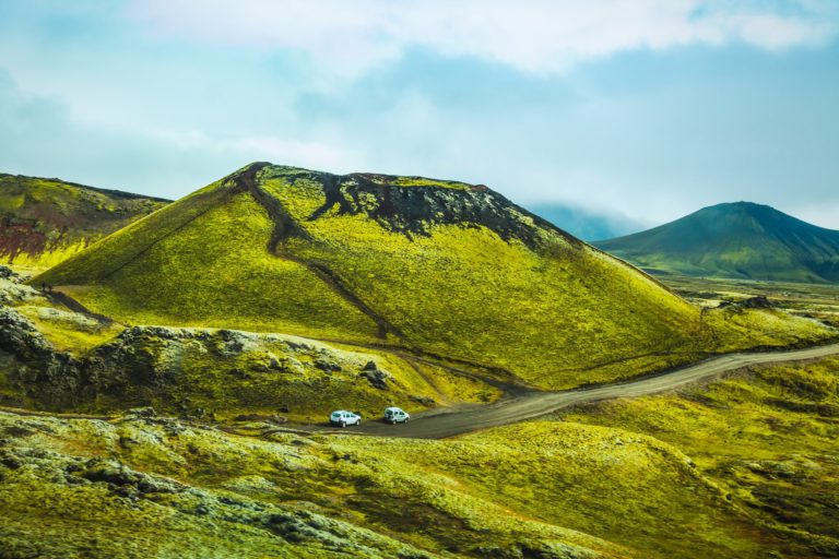
Iceland’s moonlike landscape, distinctive volcanoes, black sand beaches, colorful rhyolite mountains, columnar basalt formations, and sharp rift valleys were all created by the excessive eruptions of lava and major earthquakes. Beneath the island, you can still find a hot spot close to the surface, powering the ongoing volcanic activity in the region and providing us with geysers, hot springs, and a great source of renewable energy. Of course, this hotspot also supplies sufficient material for the volcanic eruptions that occur fairly regularly in Iceland.
How Many Active Volcanoes Are There in Iceland?
The island has 32 active volcanic systems with around 130–150 volcanic mountains. About 35 of these volcanoes have erupted over the last 10,000 years and 11 have erupted in the last century.
Iceland’s Active Volcanic Systems

There is a volcanic eruption in Iceland about every 4–10 years on average. In fact, it’s been estimated that a third of the lava that has erupted on Earth over the last 500 years was produced in Iceland.
Currently Active Volcanoes in Iceland

What Are the Most Famous Volcanoes in Iceland?
Eyjafjallajökull Volcano in South Iceland
Currently, Iceland’s most famous volcano is the hard-to-pronounce Eyjafjallajökull. Its most recent eruption took place in the spring of 2010, sprouting hot gas, ash, and lava high into the atmosphere, forcing local farmers to evacuate. But the eruption didn’t only affect Iceland, the immense amount of ash released by the volcano created a cloud that covered large swaths of northern and western Europe and affected the air travel. More than 10 million travelers were stuck at the airports for more than a week. The eruption lasted for a whole month between late March and late April. Two brand new craters were formed called Magni and Módi, named after the sons of the ancient Norse god, Thor.
The local landscape was severely affected by this volcanic activity. Before the eruption, there was a glacier tongue and a beautiful glacier lagoon close to Eyjafjallajökull. Now that the eruption has ended, nothing remains of the lagoon while the glacier tongue has almost completely melted.
Katla Volcano in South Iceland
Katla is one of the largest and most active volcanoes in Iceland. It erupts every 20–90 years on average and has done so 20 times since the 9th century. It hasn’t had an explosive eruption since 1918, a fact which has led some to conclude that Katla is due for an eruption at any time.
Sadly, there’s no way to predict an upcoming volcanic eruption because too many factors enter into the equation. As with the nearby Eyjafjallajökull volcano, Katla is also covered by Myrdalsjökull glacier. This means that if Katla were to erupt, it could be especially explosive and violent. A minor eruption, on the other hand, might not even be strong enough to break through the surface of the glacier.
Since all of this activity is hiding under the frozen mass of the glacier, it can be hard to know if any eruptions have already happened. For example, scientists believe that Katla has had minor volcanic events that relieved some of the pressure within the volcano in 1955, 1999, and 2011, but it’s impossible to know for sure.
Since 1999, Katla has given signs that an eruption might be on its way, according to geologists. The increased earthquakes in the area are one sign that an eruption might be imminent. This means that an eruption could occur anytime over the next few years or even the next few decades.

Bárðarbunga Volcano in the Grímsvötn Volcanic System
Bárðarbunga, a stratovolcano, is the second-highest mountain in Iceland. At the time of writing, the Bárðarbunga eruption of 2014–2015 was the most recent volcanic event to take place in Iceland. It was one of the largest eruptions in the country in the last two centuries, lasting 180 days and resulting in impressive lava fountain eruptions.
Luckily, the ash output from this eruption was very limited, so it didn’t cause any disruption to air traffic. Large plumes of sulfur dioxide were thrown in the atmosphere, however, causing severe air pollution across Iceland.

Eldfell Volcano on the Westman Islands
Heimaey, also known as the “Pompeii of the North,” is just one of the 15 islands that form the Westman Islands. These islands can be found south of mainland Iceland, with Heimaey serving as both the largest and the only populated island in the group.
January 22, 1973 was a fateful day for Heimaey and its 5200 residents. This is when Eldfell volcano erupted, beginning in the middle of the night. It started with a fissure opening in the ground on the edge of town.

This fissure quickly ran through the center of town, destroying roads and consuming hundreds of buildings with lava. The entire island was quickly evacuated, with the first boat leaving just half an hour after the eruption began and all residents safe on the homeland within six hours.
Nearly 400 homes were completely destroyed, buried in the lava and ash. The lava flow nearly destroyed the island’s harbor as well, but it was saved by the locals who began to constantly pump seawater on the flowing lava, redirecting the flow and stopping it from ruining the harbor and the economy of the island along with it. Of the 5200 inhabitants, only one life was lost because of this eruption.
Surtsey Island in the Westman Islands
Another famous eruption took place in the Westman Islands from 1963–1967, a decade before the Eldfell eruption. During this four-year eruption, a brand-new island measuring 2.7 km2 (1.04 sq. mi.) was formed. Surtsey is still one of the world’s newest islands.
Since the eruption stopped, large pieces of this new island have been lost to the erosion of the pounding seas, but the island still rises 155 m (508 ft.) above sea level. This new island has allowed scientists to study how life develops on newly-formed earth. It offers a fascinating opportunity for biologists, botanists, and volcanologists to watch and record how native and invasive species of plants and animals begin to colonize barren land.
This research began after the eruption ended in the 1960s and continues on to date. In fact, only specific scientists are even allowed to set foot on this island. There have been over 60 types of plants and more than 89 species of nesting bird entered into the fascinating record of life on Surtsey. Today, this is one of the most researched places on the planet. In 2008, Surtsey was declared a UNESCO World Heritage Site for its great scientific significance.
Hekla in South Iceland
In the Middle Ages, Hekla was known as the “gateway to Hell.” This distinctive cone-shaped volcano became infamous after erupting about 30 times during the 12th century. Some of these events lasted only a couple of days while others stretched on for months and years.
The longer Hekla remained quiet, the more violent the eruption that followed this break would be, or so it seemed. Over the last millennium, this volcano has produced one of the greatest quantities of lava of all the volcanoes in the world, around 8 km3 (1.9 cu mi.).
Hekla erupted four times in the 20th century. The 1947 eruption was the second largest since Iceland was first inhabited in 930 AD, covering a total of 40 km2 (15.4 sq. mi.) with fresh lava. More recently, the volcano had a two-month eruption in 1991 and an 11-day eruption in 2000.

Krafla Volcano in North Iceland
Krafla is the name of a volcanic caldera as well as of the greater volcanic system located near Lake Mývatn in North Iceland. It has erupted about 29 times since the time of the settlement. With nine of these eruptions occurring between 1975 and 1984, Krafla has a reputation as one of the country’s most active volcanoes.
One of its most famous eruptions occurred from 1724 to 1729, now known as the Mývatn Fires. A fissure measuring 90 km (56 mi.) ran along much of the length of the volcano, which sprouted magma fountains so high in the air that they could be seen from South Iceland. While there were no direct deaths caused by this eruption, it did destroy three farms. The number of indirect deaths caused by the ash and toxic fumes released by the volcano is difficult to calculate.
The second major eruption at Krafla happened much more recently, from 1975 to 1984. This consisted of nine separate eruptions that drastically changed the landscape of the area while affecting tourism, services, and industry there, too. Since then, Krafla has been calm but still provides geothermal energy to the locals.

Grímsvötn Volcano Under the Vatnajökull Ice Cap
Grímsvötn is a subglacial volcano situated near the center of Vatnajökull glacier. The volcano is covered by a 200-m (656-ft) thick ice sheet. This is Iceland’s most frequently erupting volcanic system and has multiple calderas filled with glacial water.
Grímsvötn has erupted about once per decade over the last century. The most recent eruptions occurred in autumn 2004 and spring 2011, causing major outburst floods, known as “jökulhlaups,” in South Iceland and sending plumes up into the atmosphere that reached heights of 12–17 km (7.4–10.6 mi.).
Snaefellsjökull Volcano on the Snaefellsnes Peninsula
Snæfellsjökull is an impressive glaciated stratovolcano found on the tip of the Snæfellsnes Peninsula in West Iceland. Reaching 1446 m (4744 ft.) into the sky, this mountain can be seen from Reykjavík on clear days. Although the volcano is about 700,000 years old, there is no record of any eruption happening after settlement. The volcano is believed to have last erupted between 50 AD and 350 AD.
The worldwide fame of the volcano is due to the novel Journey to the Center of the Earth, written by the French author Jules Verne in 1864. This story describes the Icelandic volcano as the entrance to the center of the Earth and a passage to the opposite side of the planet. This work of fiction has influenced many writers, poets, and filmmakers over the past century and a half.
Snæfellsjökull also has a reputation as a mystical site. Many people believe that the volcano is one of the world’s seven chakras or energy centers.

Laki Volcano in the Grímsvötn Volcanic System
Laki or Lakagígar is a chain of craters on a volcanic fissure in Vatnajökull National Park. It’s part of a volcanic system centered on Grímsvötn volcano. This system produced one of the largest volcanic events in recorded history.
Lakagígar erupted for eight months from 1783–1784, emitting an estimated 14 km3 (3.4 cu mi.) of fresh lava and destroying 20 villages. Huge clouds of poisonous gas traveled halfway across the globe, contaminating the soil across Iceland and killing 25% of the island’s human population.
The volcanic event impacted people living around the entire Northern Hemisphere for years afterward. Its direct impact on the Earth’s climate, causing a drop in global temperatures, lead to major historical events such as the French Revolution. Its role in weakening the African and Indian monsoon circulations is still being researched. Laki volcano has been dormant ever since.

Eldgjá Fissure Volcano
Eldgjá, the “fire canyon,” is another historic volcano that violently changed both the Icelandic landscape and human history. Its first documented eruption took place in 939 AD when almost 20 km3/800 km2 (12.4 cu mi./497 sq. mi.) of magma was produced, pouring over the land.
There is evidence that the summer following the eruption was one of the coolest summers across the Northern Hemisphere in 1500 years. The average temperatures in Europe, Canada, Alaska, and Central Asia were 2°C (3.6°F) lower than normal, which had a dramatic impact on people’s lives. Today, the Eldgjá system is dormant and the canyon is the largest of its type in the world.

Are There Currently Any Volcanic Eruptions Happening in Iceland?
Icelandic volcanoes are constantly monitored closely for any signs of unrest. In the first months of 2020, there were plenty of tremors around the Reykjanes volcano near Grindavík village, close to the Blue Lagoon spa. Scientists observed inflation of the surface and an increase in earthquake activity, which had been going on for months.
The largest earthquake so far reached up to 5.2 on the Richter scale. In April, a warning was issued that a larger earthquake (of up to 6.3 on the Richter scale) can be expected anytime.

The reason for this increased activity is the magma that is accumulating a few kilometers beneath the surface, which scientists say is unlikely to lead to an eruption anytime soon. There is still a slight chance that it could happen, though, and the aviation color code of the volcano has been raised from green to yellow. If there were a volcanic event, it would be a non-explosive fissure eruption, which is less dangerous.
At the time of writing this in May 2020, there is currently no ongoing volcanic eruption in Iceland. Many of the active volcanoes are believed to be overdue for an eruption, but it’s very hard to predict whether they’ll erupt in the near future or sometime in the coming years or decades.